Loop walk to one of the highest peaks in the Brecon Beacons (Fan y Big), along two ridges, Cefn Cyff and Pen y Bryn, starting from the village of Llanfrynach
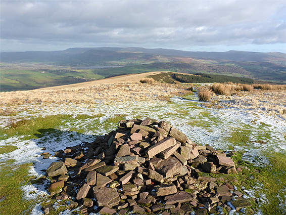
The ridges and the valleys on the north side of the central peaks of the Brecon Beacons provide many ways to reach the high country, all much less used than the popular corridor to Pen y Fan from the A470. 2,352 foot, 717 metre Fan y Big is one of the other major summits hereabouts, the seventh highest in Brecon Beacons National Park, and one of the possible loop hikes to the top is via paths along two adjacent ridges to the northeast, either side of the valley of Cwm Oergwm; a loop hike of 10 miles, climbing 1,800 feet.
The start point is the village of Llanfrynach, in the valley of the River Usk. In the anti-clockwise direction, the route is alongside a stream (Nant Menasgin) and across fields for 1.7 miles, then up the crest of a lengthy ridge, Cefn Cyff, to the summit. The return is along the main Beacons crest a way, eastwards to the edge of the next major peak, Waun Rydd, and down another ridge, over the minor summit of Pen y Bryn and finally down a track and a road back to the village, with an optional short diversion near the end, along a valley containing a stream and waterfalls. Overall, the walk encounters varied scenery and is not too strenuous, steep only along the upper ends of the two ridges.
Parking is available along the main street in the centre of Llanfrynach, opposite the local church (St Brynach's), most of which is Victorian, but incorporating a square-based, castle-like tower believed to be from the 13th century. The graveyard includes a sizeable giant redwood tree.
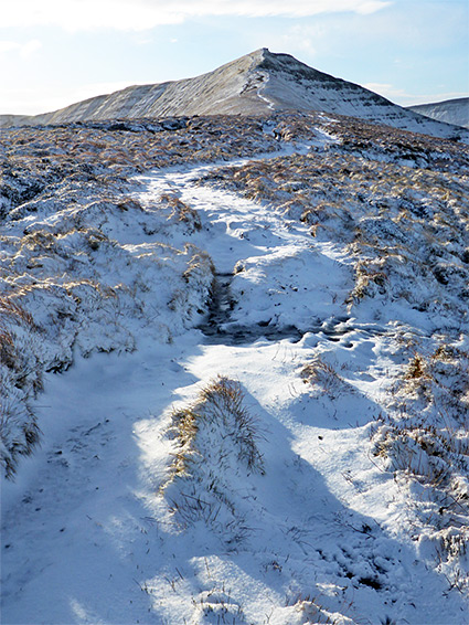
The walk from Llanfrynach starts along the westwards road a short distance, then southwest along the path that crosses a field and follows the wooded corridor of Nant Menasgin, past a couple of weirs and some small cascades. The path, part of the long-distance Three Rivers Ride, leaves the stream after a while, climbs the slope, and crosses more fields; another path continues to the settlement of Rhiwiau, just below the edge of open moorland. A track from here soon transitions to a path that begins a long, gradual ascent over grassy slopes, to the crest of Cefn Cyff, which is followed all the way to Fan y Big. Around the middle of the ridge the ground is almost level but becomes quite steep towards the upper reaches, where the path climbs through a rockier area to the top of the peak.
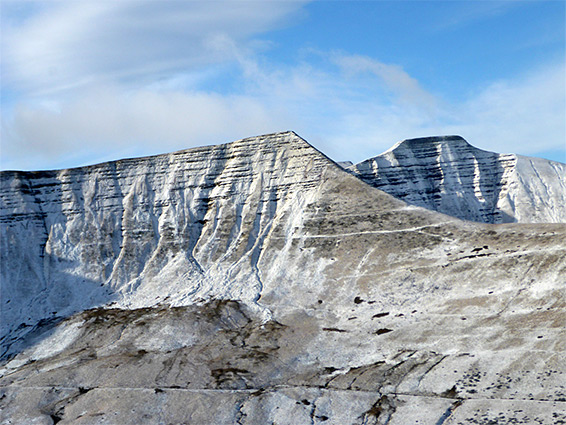
Two paths continue from the Fan y Big summit; one heads northeast, down to a saddle (Bwlch ar y Fan), and up a ridge, Craig Cwm Cynwyn, to 795 metre Cribyn, while in the other direction, the next part of the loop, the path goes down just a little before climbing again, now a little higher than Fan y Big, to an unnamed 730 metre highpoint, and on to a boggy plateau, Gwaun Cerrig Llwydion. It runs along the rim of some cliffs, Craig Cwareli and Bwlch y Ddwyallt, to a narrow strip of flat land linking with the similarly flat summit of Waun Rydd.
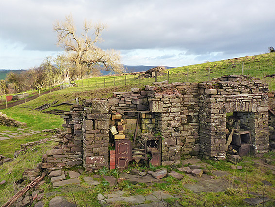
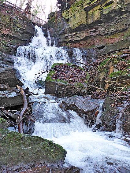
The route now is along the west edge of the summit plateau, gradually descending, across a slope named Rhiw Bwlch y Ddwyallt ('hilly gap between the two hearts'), down another long ridge which incorporates the minor summit of Pen y Bryn, then down some more, over the lower reaches of the open terrain, back to fields and patches of trees, now following a track. Along here there used to be a photogenic ruined farmhouse, Tir Hir, but this has recently been removed, in preparation for some new development. The track fords an (unnamed) stream then meets a road that leads back to Llanfrynach. An alternative ending to the walk is to follow the stream directly downhill for 0.4 miles, through an enclosed, wooded valley with pools and cascades. The lower end of the valley is beside another road to Llanfrynach.