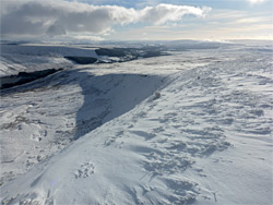
2,408 foot Fan Fawr is the highest peak of the Fforest Fawr plateau, a ten mile-wide upland area between the central Brecon Beacons to the east and the remote Black Mountain to the west, and although very close to the extremely popular Pen y Fan, it receives few visitors. The peak is similar in appearance to most others in the national park, being relatively broad, lacking a sharp high point, and surrounded on all sides by extensive grassy slopes, with only small areas of exposed rock (Old Red Sandstone). The east side falls away very steeply however, to the rugged, glacier-carved escarpment of Cefn Bach, while the other three sides are much less severe, allowing easy approaches via several paths.
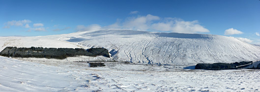
The usual route to the summit (1.1 miles) is from the northeast, starting at the Storey Arms along the A470, the same location used for one of the paths to Pen y Fan, though the hike can just as easily begin at the main parking area for this peak, at Pont ar Daf, 0.3 miles south. A third option, described below, is to approach from the southeast, beginning at a much smaller parking area along the A4059 just west of the junction with the main road, and from here the distance is only slightly longer, at 1.5 miles. This location is just downstream of the dam across the Taf Fawr that forms Beacons Reservoir, the highest in elevation of three such artificial lakes along the river. Part of the shoreline adjoins the road though most is lined by trees, and the place is one of the prettiest locations in the Beacons, set as it is below the steep east face of Fan Fawr.
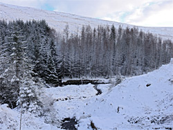
A four mile loop hike can be made by walking up to the peak from the southern carpark, then descending eastwards to the river and following this south, through a patch of dense woods and along the east shore of the reservoir, a varied walk that combines forest, river, lake and mountain landscapes, and is especially scenic during wintry conditions.
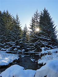
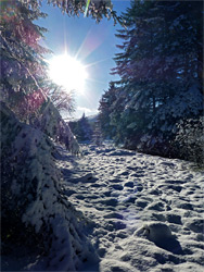
The parking place south of Beacons Reservoir rarely fills up, despite only having room for a couple of dozen vehicles. There are also parking spaces on the opposite side of the A4059, at the start of a track that follows the river southwards; this is a segment of the long-distance Taff Trail, between Merthyr Tydfil and Brecon. It is worth walking just a short distance south along this trail, through a patch of trees, to a short sequence of cascades from a tributary stream (Nant yr Eira) that joins the Taf Fawr from the west, and perhaps return directly alongside the river, through quite a dark stretch of forest, past a few pools and cascades, before emerging back to the A4059 in the vicinity of the bridge over the river. Another short diversion is to walk along a little spur path north, to the dam that forms the south end of the reservoir, and across this towards the spillway at the far side, next to the valve house, a Victorian structure built of dark-coloured sandstone.
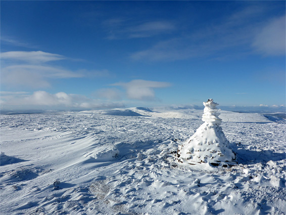
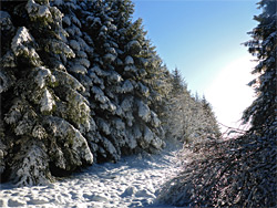
The main hiking route from the parking area, also initially along the Taff Trail, heads north, moving gradually above Beacons Reservoir, through a forest of tall pines to a gate in the fence along the east edge of the plantation, at the start of the extensive, open terrain below Fan Fawr. The most used trail stays beside the wood, leading towards Pont ar Daf, but another heads northwest directly towards the peak, close to a low ridge (Cefn yr Henriw) that leads to the much more steeply-sloping Cefn Bach. The summit is 1.3 miles from the forest edge and one thousand feet above, reached after a relatively uneventful walk at a fairly constant gradient. The high point is marked by a 3 foot cairn, and the views are of course very extensive owing to lack of any higher ground in the vicinity; south towards the Vale of Glamorgan coastline, east and west to taller, more distant peaks of the national park, and north across the valley of the River Usk.
At the summit, one path branches off westwards to the Black Mountain, while the main continuation route follows the rim of Cefn Bach to the northeast then descends, briefly very steeply down the north end of the escarpment, and then more gently over flattening, undulating land, eventually reaching the Storey Arms. A lesser trail forks off towards Pont ar Daf, and the suggested route back to the parking area south of the reservoir is to leave this path as the A470 approaches, walking southeast towards the point where the river (here known as Blaen Taf Fawr) enters the forest plantation that borders the north side of the reservoir; crossing via boulders and walking through the woods, on the east side of the stream, emerging after a few hundred feet to a grassy patch beside the reservoir, then continuing on towards the highway. The reservoir contains a tree-lined island, and all of the northern half is very photogenic.