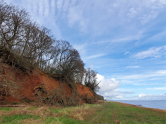
Sedbury Cliff is a low escarpment, extending about 1 mile along the west bank of the River Severn near the village of Sedbury, one mile north of Chepstow, and is similar in composition to the better known Aust Cliff on the opposite side of the estuary. Various strata are exposed; at the base are red layers of from the Mercia Mudstone Group, overlain by grey mudstones from the Blue Anchor Formation and the Penarth Group, topped by more grey layers from the Blue Lias.
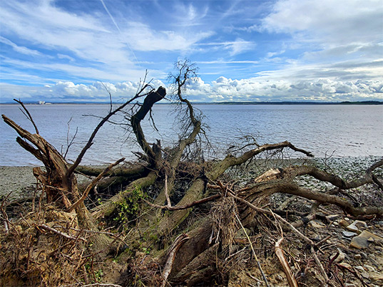
Some parts of Sedbury Cliff are bare rock but most is overgrown, and sloping rather than vertical, but still quite impressive, given that most of the Severn is bordered only by mudflats and fields. Below the cliff is a narrow strip of intertidal land, variously grass, mud, saltmarsh or stones.
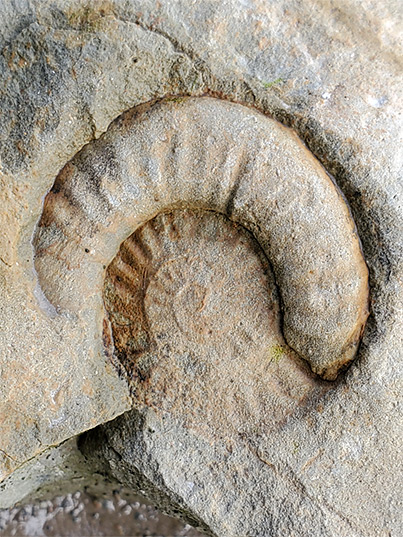
Like Aust, the cliff at Sedbury is a good location for fossils, mostly contained in the Blue Lias and Penarth formations towards the top of the cliff, and so found in fallen boulders. The mudstone at the base is rather soft, so rockfalls are common. The most frequently encountered fossils are ammonites and bivalves but fossil bones are also found occasionally.
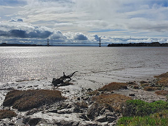
The south end of Sedbury Cliff may be reached via a short path from Beachley Road, south of Sedbury, parking a little way south along a residential street, Loop Road. The path follows right beside Offa's Dyke, and forms the southernmost component of the 177 mile Offa's Dyke Path. From the road it passes behind some houses, crosses open land at the base of a slope then traverses a patch of woodland and emerges to the edge of the Severn estuary, bordered here by a broad strip of marshy grassland. Another path heads northeast for 800 feet to the edge of the grass, beyond which are mudflats, submerged at high tide. The cliff has risen gradually, now around 100 feet high, with trees on top and bushes at the base. The shoreline becomes rockier once past a minor headland, now the foreshore, informally known as Fossil Beach, is strewn with mudstone blocks of all shapes and sizes, and this is the best location for fossil hunting. After here the land slopes down steadily, still wooded, and the inter-tidal stones are replaced once more by mud and grass. In another half mile the Severn is lined only by fields and salt marsh.