Buckholt Wood is one component of the Cotswold Commons and Beechwoods National Nature Reserve (established 1981), a collection of discontinuous areas centred on Painswick, south of Gloucester; other major sections include Edge Common and Cranham Common. The wood extends 1.3 miles across steep, south-facing slopes, part of the winding Cotswold escarpment, just north of the village of Cranham, though is part of a longer block of trees, over 3 miles across.
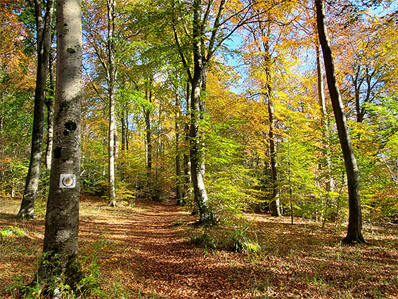
Like all of this forested area, Buckholt, an ancient English term for beech thicket, is an ancient woodland, albeit one coppiced and used for timber over the centuries, so there are no especially old trees here, but plenty of mature beech, together with alder, ash, holly, oak, whitebeam, wych elder and yew.
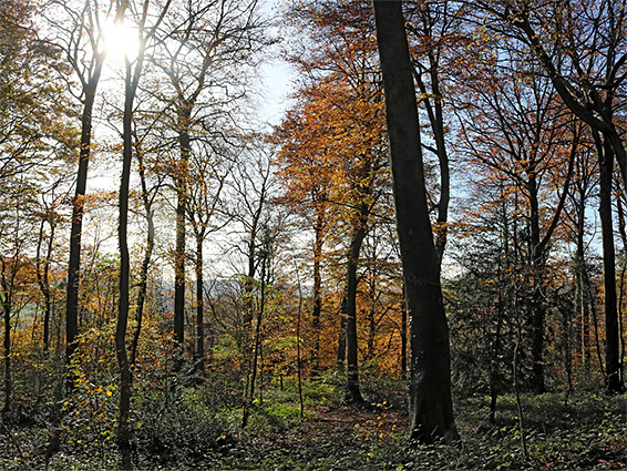
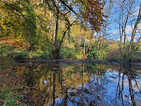
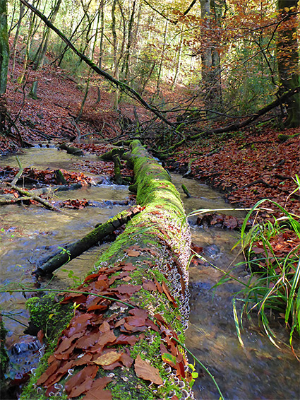
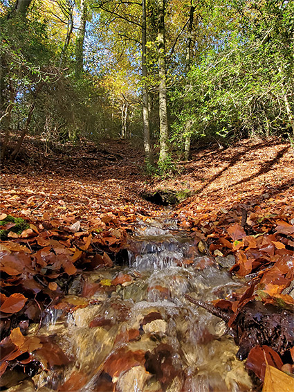
The appearances is varied - some parts are densely filled with smaller trees growing close together, while in others, the trees, principally the beech, are large and well separated. The forest floor may be empty and open, covered only by fallen leaves, or obscured by thick undergrowth. The upper reaches of the wood are fairly dry but down the slopes are number of springs, joining to form a stream, Painswick Brook, that flows east to west along or close to the lower edge of the trees.
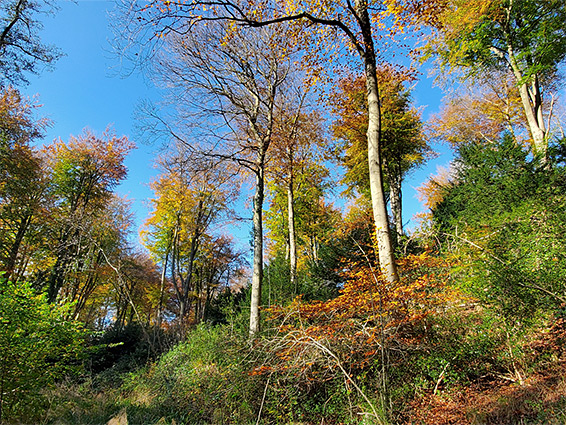
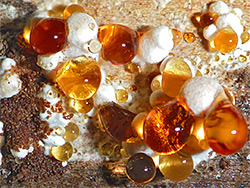
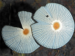
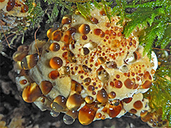
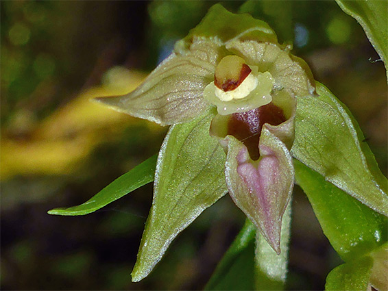
There are a few meadow-like enclosures within the woods, and other more open areas along the various paths and rides, creating a sunnier environment where more wildflowers grow, as under the thick canopy the vegetation is rather limited. Rarer wildflower species include bird's nest orchid, narrow-lipped helleborine and yellow bird's-nest. All the wood is particularly good for fungi, with well over 700 species identified here; the best areas are across the lower slopes where it is darker and wetter.
There are many entry points to Buckholt Wood. Buckholt Road runs along or close to the north edge, Sanatorium Road follows just below the southern boundary, through Cranham, and along both are various parking places, often at the entrances to tracks, and these include two main areas, one near Broadridge Mews near the northeast corner and one just west of Cranham. Paths criss-cross the slopes, some linking the two roads and so quite steep in places, others following the contours of the land, east to west. Walking away from the paths is quite easy in most places.
In the west, the wood narrows to a point, at the junction of the two roads, Buckholt and Sanatorium, near the intersection with the A46, though the trees do continue north and south, into other woods. Moving east, the land is fairly gently sloping at first, as the wood gradually widens. One section lies on the north side of Buckholt Road but most is to the south. At its widest point, the wood covers two forks of a valley, one with a field and houses, the other all tree-covered, and containing some springs that sustain a tributary of the stream. The next section includes a larger area of flat land, with steep slopes below, continuing to a lesser valley, Monks Ditch, which is crossed by a track, from Buckholt Road, that leads past a house, over the stream and onto Cranham. A bank along the north part of this track is one location of the narrow-leaved helleborine, and the stream below is perhaps the best single place for fungi. Further east is another strip of trees, now at the far eastern edge of the wood, bordering another valley, Ladlecombe, mostly grassland. South of here the trees continue, along the upper reaches of the stream and into the adjacent Cranham Wood, where the waters originate in another set of springs. A path climbs the head of the valley above the stream to an alternative access point, along Main Lane from Cranham.