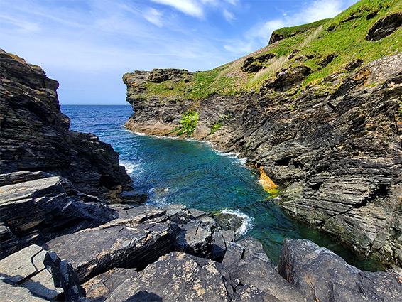
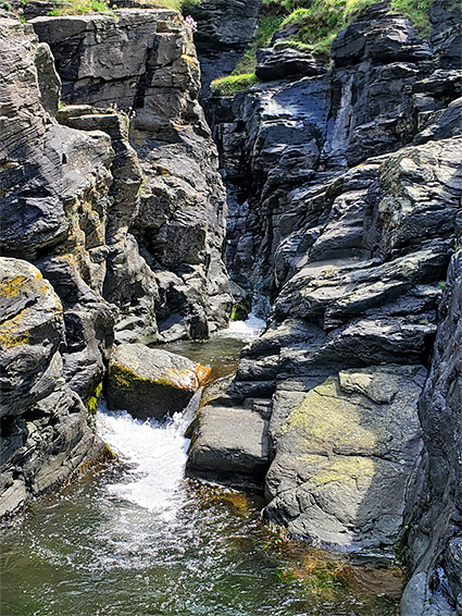
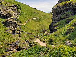
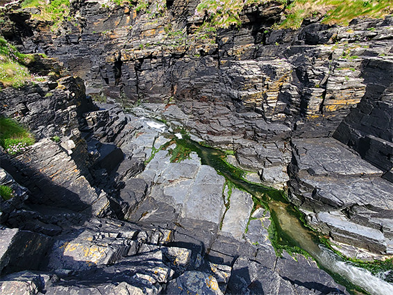
Rocky Valley is the self-descriptive name of the lower section of a short drainage, the Trevillet River, along the Cornish coast near Tintagel, which flows through a patch of damp, shady woodland then across open, bushy terrain, cutting further into the dark-coloured slate bedrock, and ending with an enclosed, slot-like stretch bordered by sheer cliffs. Here, the stream flows over waterfalls, chutes and pools, and finally meets the sea at the end of a narrow, deep water-inlet.
The coast path crosses the stream on a footbridge just above the start of the lower narrows, a location also reachable by a link path from the nearby main road, the B3263. It is easy enough to climb down from the path and explore the terraces and ledges around the narrows; entering the sea though is not advisable due to the sheer rock walls and the often large waves.
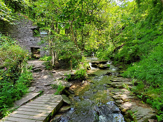
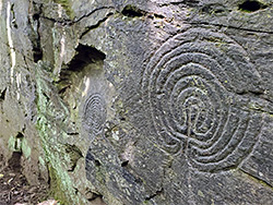
If walking from the road, the distance to the sea is only 0.4 miles, a scenic walk also passing two other features of interest, a pair of mysterious labyrinth petroglyphs, and the ruins of the late 18th century Trethevy Mill.
The Trevillet River flows only three miles, originating in the grassy high ground of Venn Down, moving west then north, meeting the coast between Tintagel and Boscastle, and is crossed by the B3263 near its lower end. Upstream of the road is a longer wooded section, and a deeper valley, leading from the beautiful, secluded waterfall of St Nectan's Glen, another popular beauty spot; in combination with Rocky Valley this must be the most scenic short stretch of streamway in the county.
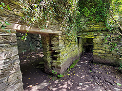
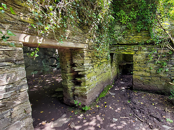
Parking for Rocky Valley is in a layby on the south side of the B3263 just west of the bridge over the stream, at the intersection with a minor road from the south. The walking route begins on the opposite side, initially down the paved driveway to Trevillet Mill, also late 18th century but long since converted to a residence, and currently available for holiday rentals. A path forks off shortly before the buildings, crossing the stream and following the east side through thick woodland, soon reaching the substantial ruins of Trethevy Mill, a series of a slate-built walls right beside the creek.
On a dark, vertical cliff just opposite are two labyrinth etchings or petroglyphs, once thought to be from the Bronze Age though now considered more likely to date from the establishment of the mill. The glyphs have in recent years become something of a shrine for followers of new age religions; the nearby trees draped with ribbons and other paraphernalia.
After the mill ruins, the path crosses back to the west side of the river, the trees fade away to be replaced by bushes and long grass, and the trail meets the coast path a short distance further. To the east this crosses the stream again on a wooden bridge and climbs a steep slope, while in the other direction it stays close to the stream, above the lower narrows, before also ascending the hillside. An easy climb down route reaches some flat terraces bordering the stream, just as it meets the sea.