Along the unnamed road between Madron and Morvah; TR20 8NU
Walk
0.7 miles
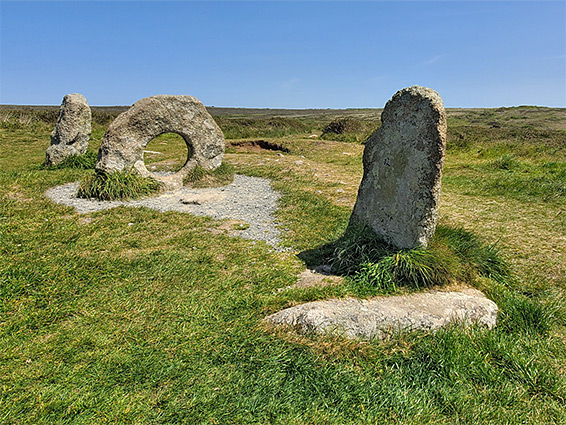
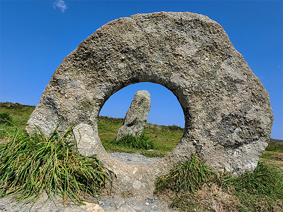
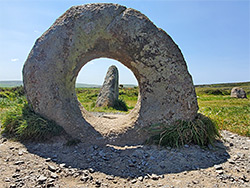
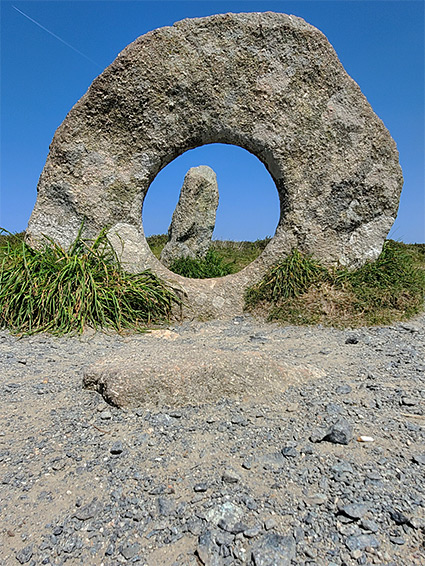
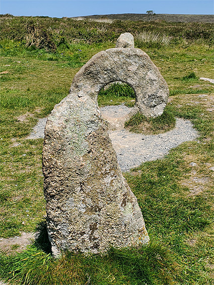
Mên-an-Tol, 'stone of the hole' in Cornish, is an ancient monument in far west Cornwall, dating from the late Neolithic or early Bronze Age, around 2500 BC. Its current form is three standing stones, arranged in a line, the outer pair approximately cylindrical, the central stone circular with a hole in the middle, this is a very rare example of a 'holed stone', with just one other instance in the county, the Torvan Stone, near Gweek. The opening could be natural but is most likely to have been created. All of the Mên-an-Tol stones are composed of granite, including several other nearby stones, some of which are partially buried.
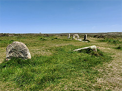
A 1769 plan of the three stones, by William Borlase, a local vicar, reveals their arrangement to be angled rather than linear; the westernmost was moved sometime in the early 19th century, and it is thought that the holed stone is also not in the original location. Most likely is that the two outer stones, several other stones close by, and others reported to have been removed by local farmers, were part of a circle, of up to 20 stones. The holed stone could have been positioned at the centre, or perhaps formed the entrance to a nearby tomb.
The site is popular and well-known, considered one of the premier ancient monuments in Cornwall, and is the subject of many legends. It may be reached by a 0.7 mile walk along a track, starting from the road between Madron and Morvah. Nearby are several other ancient relics including tumuli, the Mên Screfys (or Mên Scryfa), an inscribed standing stone, and the Nine Maidens, a stone circle, partially reconstructed. Also in the vicinity are shafts and spoil heaps from the Ding Dong Mines, the centre of which was half a mile east.
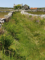
From the parking place along the road, the unpaved track heads northeast, rising gently, initially through fields, later running alongside open moorland to the east; past extant and ruined buildings from Little Higher Bosullow Farm. After 0.6 miles, a path leads eastwards for 0.1 mile to the stones, the central three of which are aligned approximately east to west. There is a fallen, mostly buried stone just below the westernmost, while a short distance further west are another fallen stone and one upright stone. Buried below the grassy surface are at least five further stones, all roughly following the outline of a circle. All three of the main group are about 1.2 metres high, while the hole of the central one is half a metre across. This megalith is also known as the crick stone, on account of its supposed powers to cure illness and disease (in particular rickets), of those who pass through the opening.